Autonomous Parametric Crop Insurance Powered by Orbit-to-Soil AI
When catastrophic droughts, flash floods, or extreme heat waves hit agricultural zones, Sentinel AgriTech detects crop trauma directly from orbit and triggers instantaneous indemnification payouts through smart contracts. Zero manual claims. Zero bureaucratic adjusters. 100% mathematical certainty.
Synthetic Aperture Radar (SAR) with dual-polarization C-Band penetrating clouds and precipitation.
Real-time vegetation reflectance comparing near-infrared and red light to quantify biomass density.
From satellite anomaly breach verification to automated mobile money wallet disbursement.
The Orbit-to-Farmer Pipeline: Eliminating Claims Friction
High-Frequency Planetary Observation Penetrates Cloud Cover & Canopy
Our distributed geospatial ML pipeline continuously ingests multi-spectral optical and Synthetic Aperture Radar (SAR) telemetry across agricultural parcels worldwide. Unlike standard cameras, SAR radar pulses penetrate thick cloud covers, dust storms, and dense rain to directly measure soil dielectric properties, standing flood water depths, and canopy structural biomass down to 10-meter parcel grids.
Predictable Protection Scaled from Smallholder Collectives to Sovereign Nations
No hidden exclusions, zero claims adjusters, and guaranteed deterministic liquidity. Choose the parametric coverage tier built for your land area and risk exposure.
Smallholder Cooperative
Ideal for regional agricultural cooperatives, micro-lending institutions, and smallholder farmer unions pooling collective climate risk.
- Field-level 10m NDVI & soil moisture anomaly tracking
- Automated payout routing directly to member Mobile Money accounts
- Single-peril drought or excessive rainfall parametric trigger
- Localized cooperative SMS weather alerts and frost warnings
- Zero paperwork, claims adjusters, or physical inspection fees
- End-of-season actuarial harvest report
Commercial Agro-Enterprise
Designed for medium-to-large commercial farms, corporate plantations, seed developers, and agricultural commodity exporters.
- Everything in Smallholder Cooperative, plus:
- Sub-field 3m high-resolution multispectral phenology scanning
- Multi-peril protection: Drought, Extreme Heat Degree-Days, Flood, Storm Wind-Shear
- Direct ERP and Farm Management API integration
- Dedicated Multi-Signature Treasury Vaults with automated collateral hedging
- Custom multi-index threshold calibration (NDVI + NDRE + SAR Soil Dielectric)
- Priority satellite tasking during forecasted extreme weather windows
Sovereign & Reinsurance Consortium
Tailored for national Ministries of Agriculture, global reinsurers, development finance institutions, and sovereign catastrophe funds.
- National-scale macro-economic crop failure and food security risk hedging
- Sovereign Catastrophe Bond (Cat Bond) automated liquidity execution
- Dedicated C-band and L-band Synthetic Aperture Radar (SAR) constellation tasking
- Full white-label government relief distribution portal and API
- Actuarial solvency auditing with decentralized validator oracle consensus
- Dedicated 24/7 orbital flight dynamics team and climate risk actuaries
Architecting Autonomous Financial Defense for Global Food Systems
“Our mission is to decouple global food security from catastrophic climate volatility. By fusing orbital remote sensing with deterministic smart contracts, Sentinel AgriTech replaces broken, bureaucratic insurance claims with instantaneous, transparent financial resilience for every agricultural producer on Earth.”
Deterministic Certainty
Mathematics and satellite physics replace human subjectivity. If the physical threshold is breached, the policy pays autonomously.
Radical Speed
Liquidity must arrive when fields are flooded or parched—not eighteen months later in an arbitration room.
Universal Access
From a three-hectare cassava smallholder to a million-hectare wheat grain belt, satellite orbits cover every field without physical gatekeepers.
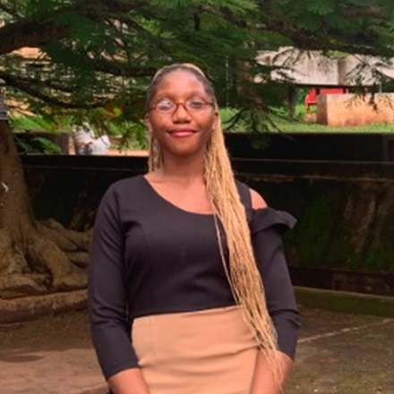
Chioma
Chioma is a climate-tech innovator and software systems architect dedicated to protecting agricultural livelihoods against accelerating climate volatility. Combining deep domain focus across geospatial intelligence, predictive weather modeling, and automated financial infrastructure, she founded Sentinel AgriTech to eliminate the operational friction that leaves millions of smallholder and commercial farmers uninsured. Having seen how slow, manual loss assessments and fragmented insurance rails leave farming communities exposed when droughts or floods strike, Chioma engineered an orbit-to-soil parametric indemnification platform—translating continuous multi-spectral satellite telemetry into instant, transparent payouts via mobile wallets and smart contracts.
“Food security cannot wait on manual claims adjusters and months of paperwork while crops fail. When satellites can verify drought or flood trauma directly from orbit, our infrastructure ensures relief reaches farmers’ mobile wallets in minutes—before a bad season becomes generational loss.”
Establish Uplink with Sentinel Ground Control
Whether you are an agricultural cooperative leader seeking regional protection, a commercial agro-enterprise deploying multi-peril coverage, or a reinsurance syndicate underwriting sovereign risk, our flight operations and actuarial team are ready.
REQUEST PARAMETRIC RISK AUDIT
Transmit your farm coordinates and peril profile directly to our underwriting models.